Info Point
B
O
R
G
O
D
I
C
E
S
I
Loading
- info@cesiportadellumbria.it
- Cesi, 05100 Terni (TR), Umbria, Italia
Cycle along the Nera Greenway: over 180 km of dirt tracks and scenic landscapes among rivers, villages, and the Apennines!

The Nera Greenway is a long green route, mostly made up of unpaved paths suitable for walking, cycling, or horseback riding, running alongside the Nera River. Essentially, the Greenway connects various trails and cycle routes into a large 180-kilometer loop: Benedictine itineraries, the Via Francigena of Saint Francis, and the former Spoleto-Norcia railway line.
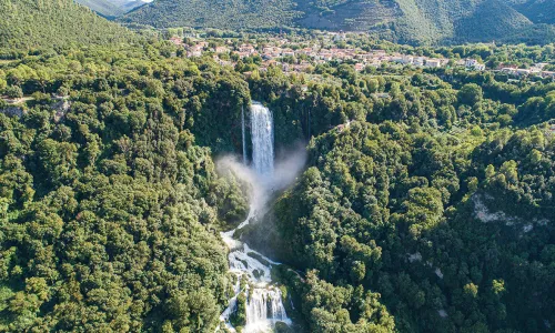
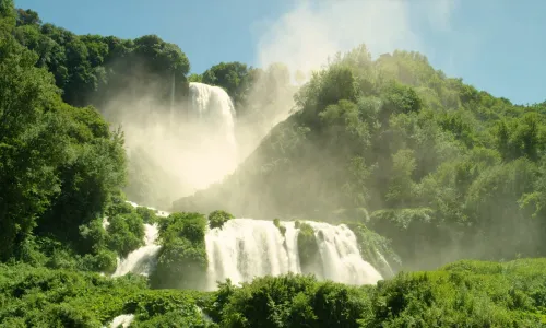
Along the Greenway, from the Marmore Falls to the junction for Preci, it is possible to follow the left bank of the Nera River using one of the longest and most interesting dirt tracks in Central Italy. This mainly flat section is connected to a mountain route that leaves the Valnerina valley and passes through Preci, Norcia, Cascia, and Monteleone di Spoleto. It then climbs to the former Papal customs post at Salto del Cieco, descends to Lake Piediluco, ascends toward the Prati di Stroncone plateau, and finally returns to the waterfall through Campacci di Marmore.
The Nera Greenway can be explored in stages; it has been divided into 16 sections ranging from 5 to 22 kilometers in length. Many of these sections form loop routes, allowing visitors to return easily to their starting point without retracing the same path. By combining multiple sections, it is possible to plan a multi-day journey of any desired length. Many stretches along the river are mostly flat, but from Preci back toward the Marmore Falls there are some fairly demanding climbs. These can be avoided by choosing alternative paved routes along quiet, lightly trafficked roads.
How to get there
The Greenway can be started at many points, but the ideal starting location is the Marmore Falls. The lower viewpoint of the waterfall can be reached from Terni - and from the A1 motorway by exiting at Orte - by following Regional Road 209 “Valnerina.” The waterfall is just six kilometers from the city. It can also be reached from Rieti via State Road 79 bis by taking the Valnerina exit. Paid parking areas are available at Marmore Falls, which can also be reached from Terni by public bus.